
Sabaloka: ancient volcanoes at the Sixth Cataract
Updated:
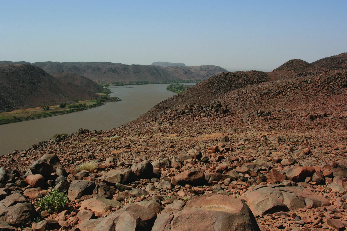
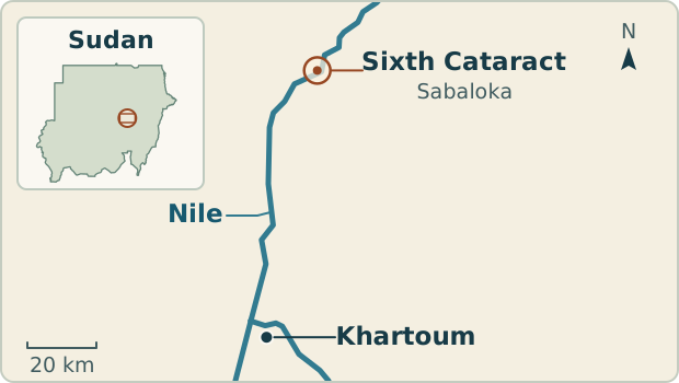
At Sabaloka, north of Khartoum, the Nile enters a rocky passage known as the Sixth Cataract. The gorge exposes some of the area’s oldest rocks alongside the remains of an ancient volcanic system. Weathering and the river have reshaped both into the landscape we see today.
The ancient basement
Around 80 km downstream from the meeting of the Blue and White Niles, the flat plains give way to rocky slopes and islands. Sand and gravel collect on low surfaces among the outcrops. A cliff can be cut into ancient rock long after that rock formed, so the age of the gorge and the age of the rocks it exposes belong to different parts of the story.
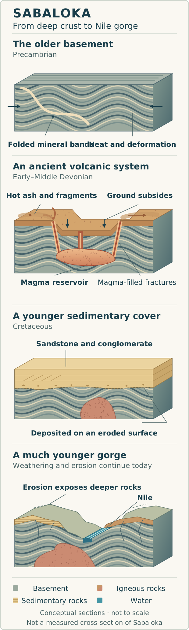
The oldest rocks at Sabaloka include gneiss, migmatite and granulite. Gneiss contains bands of minerals that can form or change as rock is heated and deformed. In migmatite, some material has melted and solidified again. Granulite preserves minerals that formed at high temperatures deep in the crust. Studies of the rocks describe more than one stage of heating and deformation.[1][7]
Uplift and erosion brought this older foundation into view. Field observations and gravity measurements support an interpretation in which erosion exposed deeply metamorphosed crust. Geologists call this exposure a basement inlier: a patch of older rock within an area where younger rocks commonly cover it.[2]
An eroded volcanic system
Magma entered the older basement during the Devonian. Dating places the Sabaloka complex in the Early to Middle Devonian. It includes rhyolite, ignimbrite and granite. Rhyolite records relatively fast cooling at or near the surface. Granite cooled more slowly underground, giving crystals time to grow. Erosion now exposes rocks that formed at different depths.[3]
Ignimbrite forms when a hot mixture of volcanic particles and gas rushes across the ground and leaves a deposit. Some deposits were hot enough for their particles to weld together. At Sabaloka, Almond identified bodies interpreted as conduits that fed an overlying ignimbrite sheet. Their shape, internal textures and contacts connect the rocks below ground with the products of eruption at the surface.[4]
When an eruption withdraws magma, the roof above the reservoir can subside along fractures. Magma that solidifies in a curved fracture forms a ring dyke. Such intrusions can preserve the shape of parts of a volcanic system long after erosion has removed its original surface. At Sabaloka, the geological ring is read from mapped rock bodies and contacts.[4][6]
The younger sedimentary cover
Sedimentary rocks preserve a later chapter. Field studies describe Cretaceous sandstone, conglomerate (rock made of cemented gravel) and minor mudstone at Sabaloka and nearby Ban Gadeed. Layers and cross-bedding record deposition by ancient rivers, long before the modern Nile gorge. These rocks rest on an eroded surface of much older rocks.[5]
At Jebel Rauwiyan, silicified sandstone survives as an isolated remnant above gneiss and ring-dyke intrusions. Older studies call these rocks “Nubian Sandstone”. That broad historical label groups rocks of different ages and should not be treated as one precise formation name.[5]
The Nile and the Sixth Cataract
The Sixth Cataract is a rocky stretch of the river where outcrops divide the flow into channels and create local rapids. Sand and gravel settle where the current weakens. As the water level changes, low islands and sediment banks can appear or disappear. The river is still shaping these small features within a much older rock framework.
Fractures divide the rock into blocks. Weathering loosens some of those blocks, and water can carry away smaller fragments. The spacing of fractures and the resistance of different rocks help shape the channels. The gorge shows the effect of those processes on the exposed rock, while the older volcanic history is recorded in the rocks and their contacts.[8]
Sources
- Almond, D. C. (1980). Precambrian events at Sabaloka, near Khartoum, and their significance in the chronology of the basement complex of North-East Africa.
- Dawoud, A. S. & Sadig, A. A. (1988). Structural and gravity evidence for an uplifted Pan-African granulite terrain in the Sabaloka Inlier, Sudan.
- Soffel, H. C. et al. (1990). The Sabaloka ring complex revisited: palaeomagnetism and rockmagnetism.
- Almond, D. C. (1971). Ignimbrite vents in the Sabaloka cauldron, Sudan.
- Abdelateif, F. A. (2009). Late Cretaceous Nubian Sandstone (LCNS): Sedimentological, depositional and source area. Sabaloka–Ban Gadeed area, Sudan. GRMENA III conference paper.
- Almond, D. C. (1977). The Sabaloka igneous complex, Sudan. Philosophical Transactions of the Royal Society of London, Series A, 287(1348), 595–633.
- Karmakar, S. & Schenk, V. (2015). Neoproterozoic metamorphic events along the eastern margin of the East Sahara Ghost Craton at Sabaloka and Bayuda, Sudan: Petrology and texturally controlled in-situ monazite dating. Precambrian Research, 269, 217–241.
- الرديسي، سمير محمد علي حسن، والحسين، انتصار عبد الحفيظ (٢٠١٨). السمات الجيومورفولوجية والمورفومترية للأودية الموسمية في منطقة السبلوقة – شمال الخرطوم – السودان. مجلة كلية التربية، جامعة الخرطوم، العدد ١١، ١٥٤–١٨٠.